Periyaare, Periyaare, Parvathanirayude Panineere…
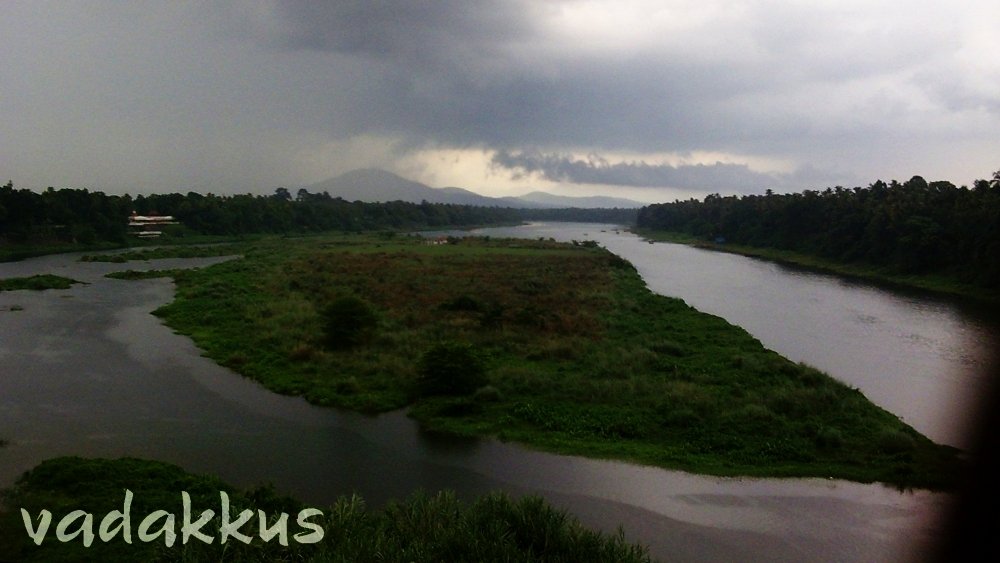
The Periyar river flows around an island at Kalady in south-central Kerala. The rain is falling on the river and all around as the darkened skies clear the decks for another of the epic Kerala rains. It seems to be late in the evening even though it is only 1.45 pm. The photo was taken from the creaking Sree Sankaracharya bridge which carries the MC Road across the Periyar, looking east towards the far-away mountains where the river originates, in the remote reaches of the mountainous Idukki district of Kerala which lies across the Western Ghats. The white structure to the left of the picture is Sree Sankaracharya’s birth place.
The Periyar is the second longest river in Kerala after the Bharathapuzha and historically probably the single-most important entity in the history of the state. The Periyar formed and shaped the culture of South-Central Kerala. It created the ancient port of Muziris which attracted traders from Arabia to Rome to the shores of Kerala, and then destroyed it by flooding it in 1581. The result was Kochi. She held off Tipu’s armies from conquering Travancore and formed the boundary between the Kochi and Travancore states. The Idukki Hydroelectric project which supplies power to all of Kerala is located on the Periyar, as is the notorious Mullaperiyar dam.
The Periyar was once a powerful force of nature has been tamed to an extent and is today only a shadow of her former self. But she is only sleeping, and her fury as the port and city-destroyer will be unmatched if she decided to wake up.


Waaah…. Superb description… Lots of Informations from a simple and single pic.. Keep writing .. Keep Clicking. 🙂